A New Generation of Aerial Technology for Mars Exploration
A new generation of aerial technology is set to revolutionize the way scientists locate water on Mars, offering unprecedented precision that could reshape future exploration missions. In a study published on March 24 in the Journal of Geophysical Research: Planets, researchers have demonstrated that low-flying drones equipped with ground-penetrating radar can map buried ice with remarkable accuracy, something that orbiting spacecraft have struggled to achieve. By adapting techniques tested on Earth’s debris-covered glaciers, scientists are now outlining a practical path toward identifying accessible water resources on the Red Planet, a crucial requirement for long-term human exploration.
Mapping Hidden Ice With Unmatched Precision
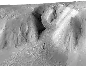
For decades, Mars exploration has relied heavily on orbital instruments like SHARAD aboard NASA’s Mars Reconnaissance Orbiter to detect subsurface ice deposits. These tools have confirmed vast reservoirs of frozen water beneath layers of dust and rock, especially across mid-latitude regions. However, their resolution remains limited when it comes to shallow depths, leaving critical uncertainties about how accessible that ice truly is.
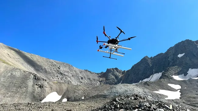
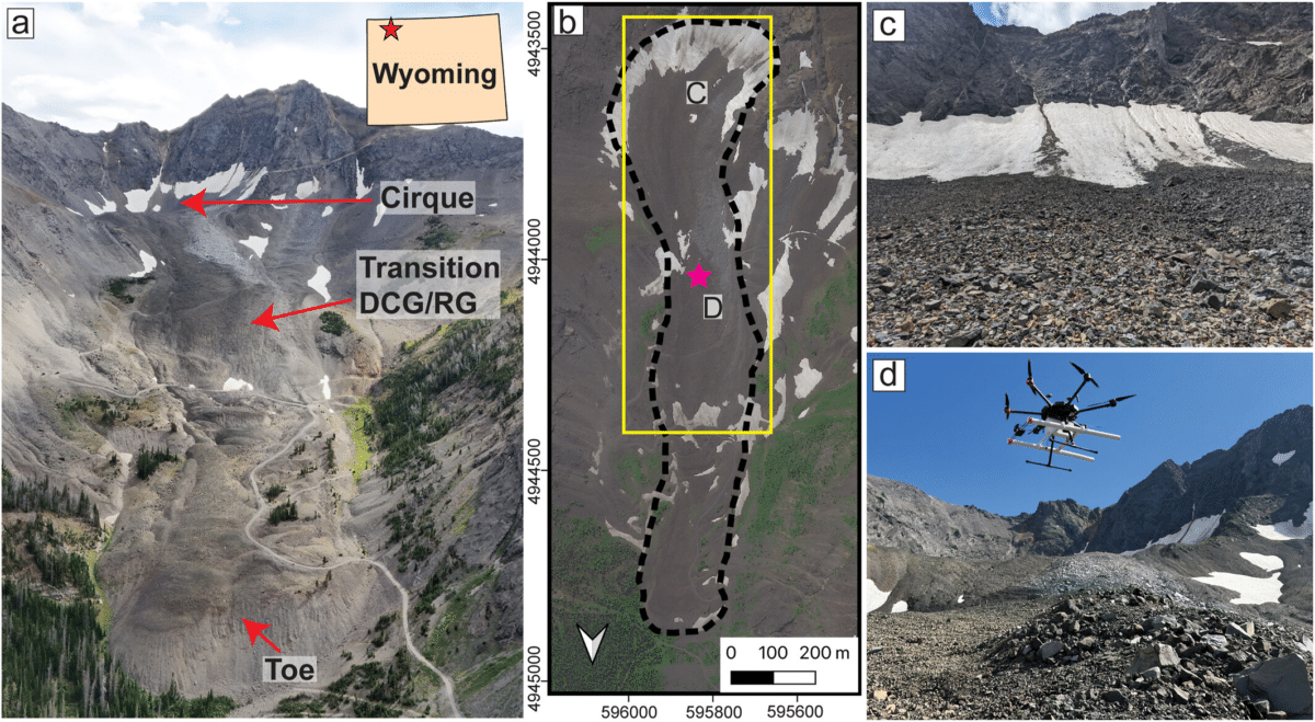
The new research tackles this limitation head-on by bringing radar systems closer to the ground. Using drone-mounted instruments over glaciers in Alaska and Wyoming, chosen for their similarity to Martian terrain, the team successfully mapped ice thickness, detected thin debris layers, and revealed internal structures with striking clarity. These findings were validated through direct field measurements, including drilling and excavation, alongside simulations confirming the radar signals originated beneath the surface.
“If you want to make decisions about where to drill on Mars, you need to know if the ice you’re trying to find is under one meter of debris or 10,” said Roberto Aguilar, lead author of the study and a doctoral researcher at the University of Arizona Lunar and Planetary Laboratory. “That’s the kind of information a drone-based system could provide.”
The ability to distinguish between shallow and deeply buried ice could shape mission planning in profound ways, guiding landers toward locations where extraction is feasible rather than speculative.
From Earth Glaciers To Martian Landscapes
The research team did more than demonstrate feasibility; they established a working model for how drone-based radar systems should operate in real-world conditions. By flying repeated survey patterns over terrestrial glaciers, they refined key operational parameters such as altitude, speed, and directional alignment relative to ice flow. These details proved critical for maximizing signal clarity and minimizing distortion.
“We already knew ground-penetrating radar works, but this was the first time we mounted it to drones and tested how we could put it into practice,” Aguilar explained. “For instance, we learned at what altitude and speed the drone should fly, as well as the importance of flying in the direction of the glacier’s flow, and how to make sure the radar was properly aligned to detect the ice.”
The study highlights how these Earth-based experiments serve as direct analogs for Martian conditions. Debris-covered glaciers on our planet mimic the structure of ice deposits observed on Mars, where layers of dust and rock obscure frozen water below. By proving that drone radar can resolve these layers in detail, the research establishes a scalable approach for extraterrestrial exploration.
Such advancements suggest that future Mars missions may rely less on broad estimations and more on precise, localized data when selecting drilling sites.
A New Layer In Mars Exploration Strategy
Rather than replacing existing technologies, drone-based radar introduces a new layer in a multi-tiered exploration framework. Orbiters would continue to identify large-scale regions of interest, while aerial drones refine those maps with high-resolution subsurface imaging. Surface missions could then target the most promising locations with far greater confidence, reducing both risk and operational cost.
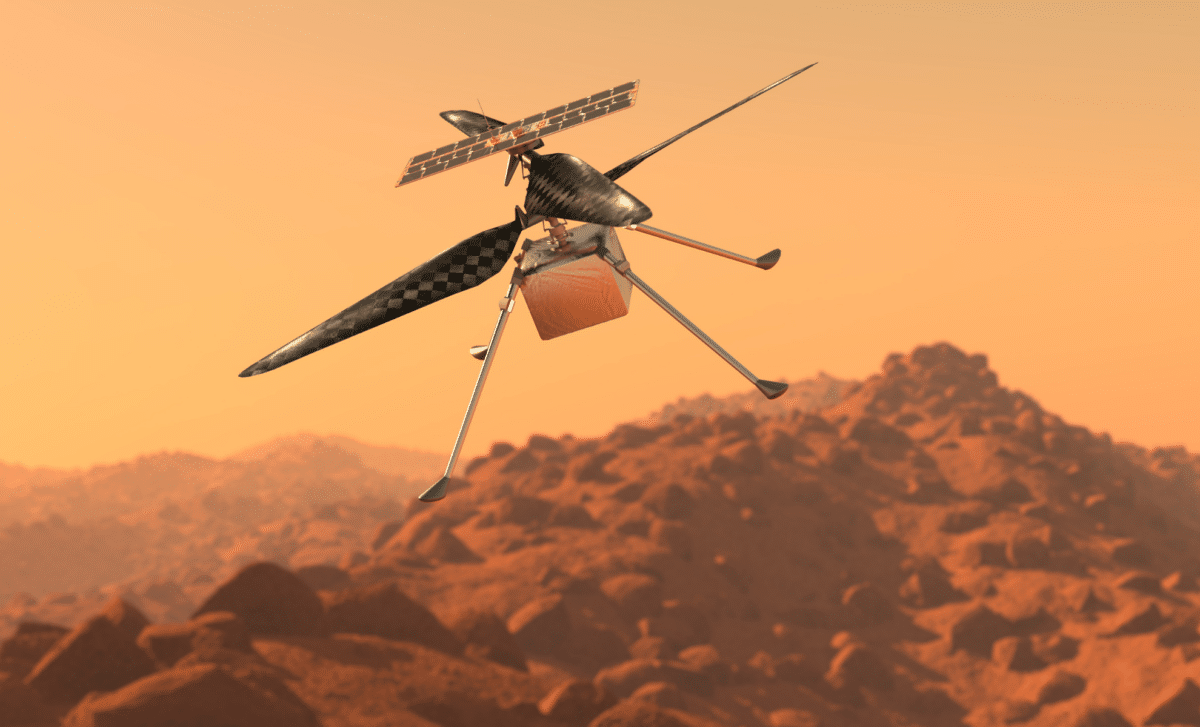
This approach builds directly on the success of NASA’s Ingenuity helicopter, which proved that powered flight is possible in Mars’ thin atmosphere. Future aerial platforms could carry more advanced scientific payloads, including radar systems capable of scanning beneath the surface in real time.
“We are filling the gap between today’s orbital observations and a more distant future, where astronauts land on Mars and make observations on the ground,” Aguilar said. “This gives us a way to investigate the glaciers now, from the air.”
By bridging this gap, drone technology transforms exploration into a more adaptive and data-driven process. Instead of relying on incomplete orbital snapshots, mission planners could make informed decisions based on detailed subsurface maps collected just meters above the terrain.
Toward Practical Water Access On Mars
Water is central to every long-term vision for Mars, from sustaining human crews to producing fuel and oxygen. Yet accessibility remains the defining challenge. Ice buried too deep beneath hardened debris may be technically present but practically unusable.
Drone-mounted radar changes that equation by turning detection into actionable intelligence. It enables scientists to quantify not just where ice exists, but how reachable it is, an insight that directly impacts mission feasibility. As exploration strategies evolve, the integration of aerial scouting systems could mark a turning point, shifting the search for Martian water from broad discovery to precise resource mapping.
By borrowing proven methods from Earth and adapting them for another world, researchers are quietly laying the groundwork for a future where accessing water on Mars is no longer a gamble, but a calculated step forward.